We’ve made huge strides towards finding exoplanets and surveying the other worlds in our solar system recently — but most of us will never know what it’s like to stand on another soil, especially under another sun. Good thing there are a lot of places on Earth that you could easily mistake for strange new worlds. No wonder that traveling is one of the best forms of recreation – even looking at these pictures takes your mind to far away places… And yes, all those of those places are real!
The Bosnian pyramid of the sun
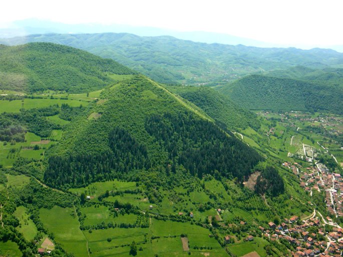
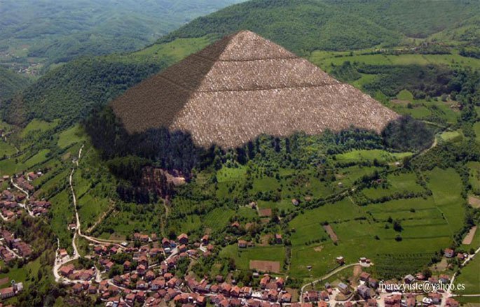 The Osmanagić pyramid hypothesis (or Bosnian pyramids) is a concept promoted by author Semir Osmanagić, who asserts that a cluster of natural hills in central Bosnia and Herzegovina are the largest human-made ancient pyramids on Earth. The hills are located near the town of Visoko, northwest of Sarajevo. Visočica hill, where the Old town of Visoki was once sited, became the focus of international attention in October 2005, following a news-media campaign promoted by Osmanagić and his supporters.
Japan’s Ancient Underwater “Pyramid”
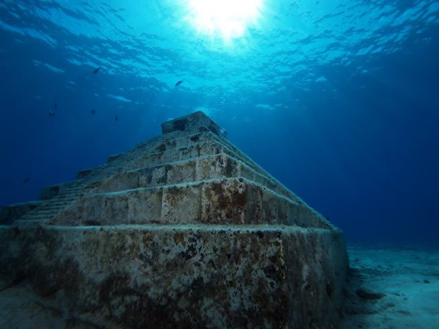
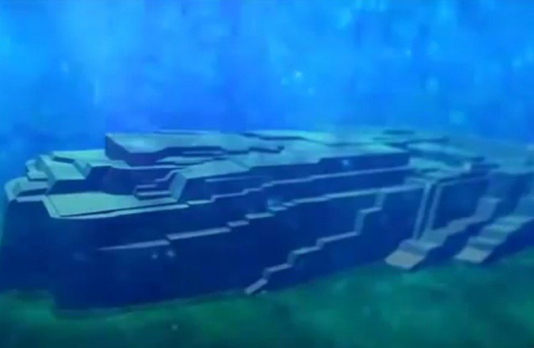
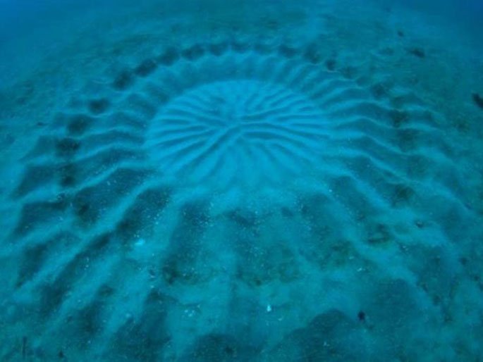
Submerged stone structures lying just below the waters off Yonaguni Jima are actually the ruins of a Japanese Atlantis—an ancient city sunk by an earthquake about 2,000 years ago.
That’s the belief of Masaaki Kimura, a marine geologist at the University of the Ryukyus in Japan who has been diving at the site to measure and map its formations for more than 15 years.
Alien Face hidden to look like mountains in Canada, Google Earth discovery, UFO sighting news
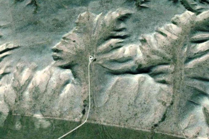
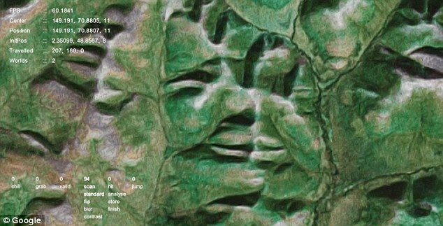
These objects can be clearly made out of the face:
chin, neck, lips, nose, nostrils, eye, eye lid, forehead, hair or hat line, shoulders, clothing over the shoulders, V shape of neck and chest between robe, tall crown or headdress indicating of royal birth.This face must have been made hundreds of thousands even millions of years ago, but was it a great race of indians in Canada that made it for the gods to look down upon or was it made by an alien race? If it was made by an alien race, it could have been made millions of years ago, also then it might be the face of a great man from their species, for things like this are only created out of love for the person.
Richat Structure (also known as the Eye of the Sahara), a circular structure in the Sahara desert near Ouadane, Mauritania
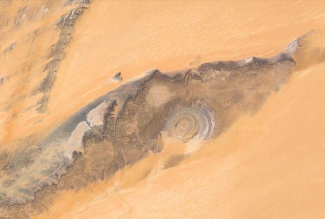
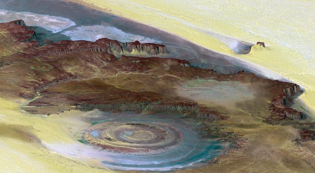
The Richat Structure, also known as the Eye of the Sahara and Guelb er Richat, is a prominent circular feature in the Sahara desert of west–central Mauritania near Ouadane. This structure is a deeply eroded, slightly elliptical, 40 km in diameter dome. The sedimentary rock exposed in this dome ranges in age from Late Proterozoic within the center of the dome to Ordovician sandstone around its edges. The sedimentary rocks comprising this structure dip outward at 10°–20°. Differential erosion of resistant layers of quartzite has created high-relief circular cuestas. Its center consists of a siliceous breccia covering an area that is at least 3 km in diameter.
Etosha pan in Namibia, similar to the Saturn’s largest moon, Titan.

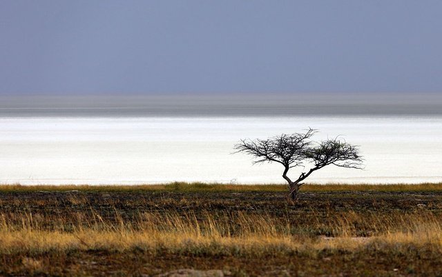
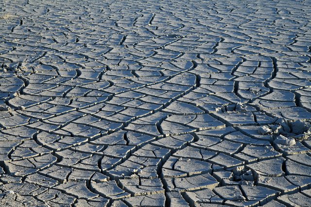
The shallow hydrocarbon lakes on Titan are behaving like a salt pan on Earth.
Cano Costales Colombias- Stunning river of five colors


Waiotapu (or Wai-O-Tapu) in new Zealand’s Taupo Volcanic Zone with colorful hot springs
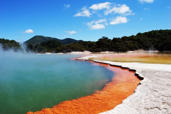
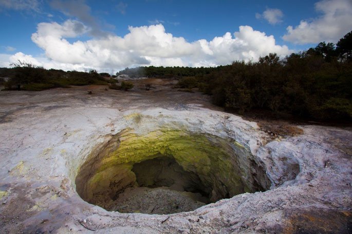
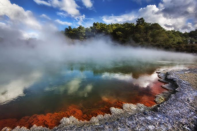
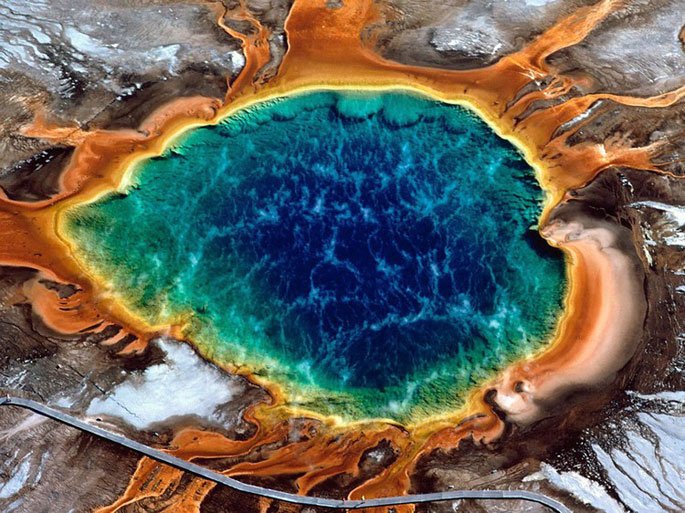
Wai-O-Tapu (Māori for “sacred waters”) is an active geothermal area at the southern end of the Okataina Volcanic Centre, just north of the Reporoa caldera, in New Zealand’s Taupo Volcanic Zone. It is 27 kilometres south of Rotorua.[1] The area has many hot springs noted for their colourful appearance, in addition to the Lady Knox Geyser, Champagne Pool, Artist’s Palette, Primrose Terrace and boiling mud pools. The geothermal area covers 18 square kilometres.[1] Prior to European occupation the area was the homeland of the Ngati Whaoa tribe who descended from those on the Arawa waka (canoe).
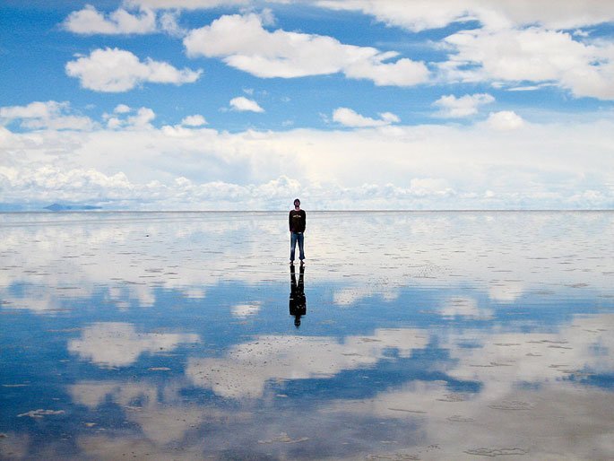
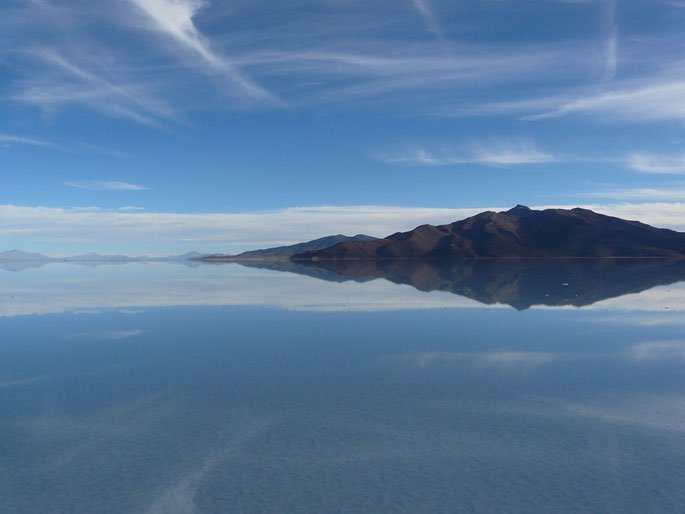
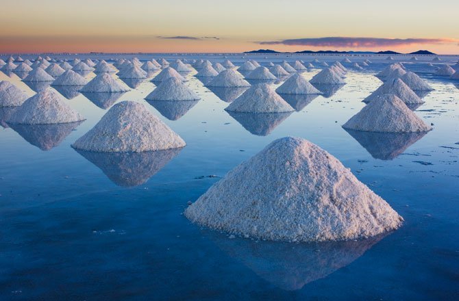
Salar de Uyuni, the world’s largest salt flat (10,582 sq km or 4,086 sq mi) in southwest Bolivia, contains at least the half of the world’s lithium reserves

Great Blue Hole, a 406 ft (124 m) deep circular submarine sinkhole Belize with a radius of 984 ft (300 m), formed during quaternary glaciation and made famous by Jacques Cousteau as a scuba diving site.
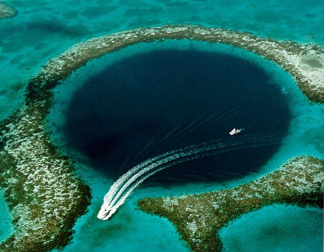
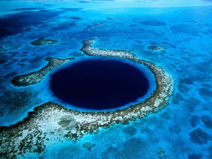 People in Belize think it should be one of the seven wonders of the world. Dive boats visit it every day. It is protected by the Belize Audubon Society and is a Belize National Monument. It became a World Heritage site in 1997. Jacques Cousteau took the Calypso and his one-man submarines into the hole in 1972 to examine stalactites suspended from overhanging walls. The Great Blue Hole is surrounded by shallow water of Lighthouse Reef Atoll, a nearly perfect circle in the middle of a shallow reef. The atoll is located ~96 km east of the Belize mainland. It is not an easy place to reach.
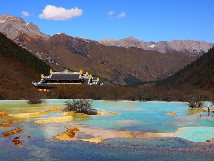
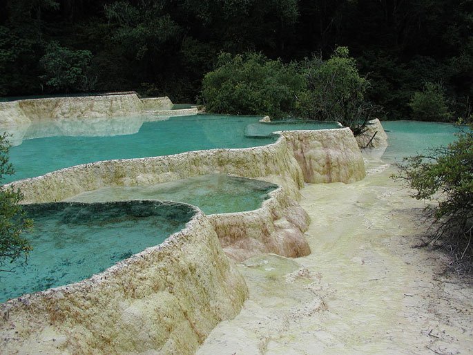
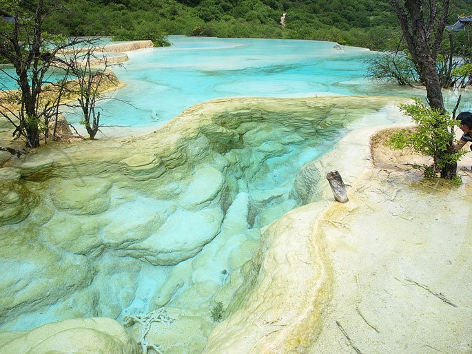
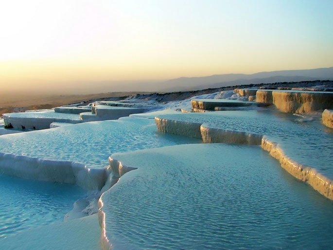
Huanglong, northwest Sichuan, China, known for some colorful pools formed by calcite deposits.
Vale da Lua (Valley of the Moon) in Chapada dos Veadeiros National Park, Brazil with some of the oldest rock formations on Earth
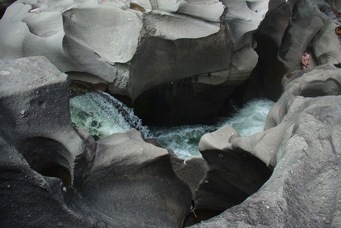
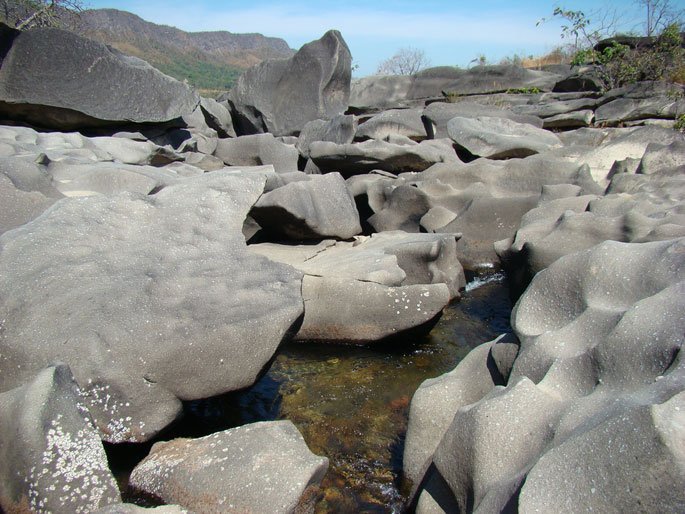
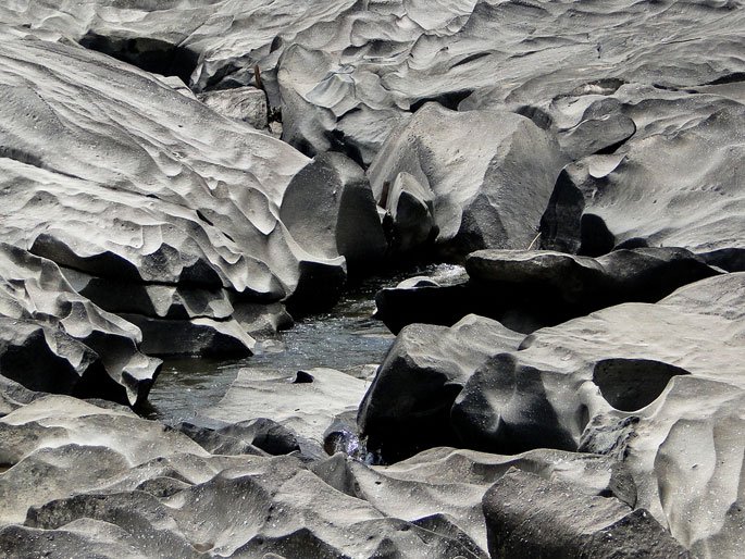
Is one of the oldest, most beautifully diverse and unusual tropical ecosystems in South America. The National Park has over 161,891 acres (65,515 hectares) of gorgeous landscape full of exotic flora and fauna, lots of spectacular waterfalls, bizarre rock formations, caves and grottoes. According to NASA, when observed from outer space, the Chapada’s high plateaus are the most luminous point visible on Earth; this bright glowing is caused by the reflection between the sun and the abundance of quartz crystal in the region.
The windy McMurdo Dry Valleys in Antarctica without snow. Here is the longest river (or rather, meltwater steam) of the continent named the Onyx. There are no fish, but it supports microscopic life.
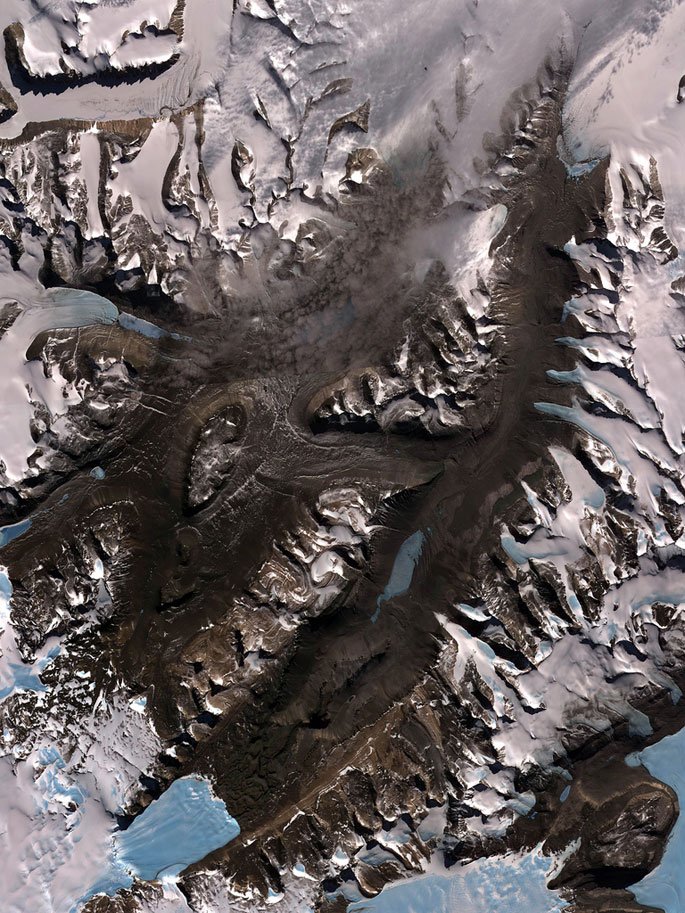
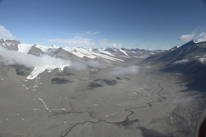
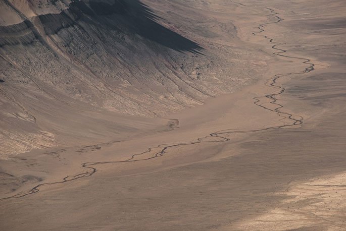
The Dry Valleys are an Antarctic anomaly. While most of the continent is covered in a thick layer of ice, the dry, frigid Valleys are almost entirely ice-free, an arid expanse of mostly dirt, small rocks, and big boulders. The Valleys are dotted with a few frozen lakes, and, during the austral summer, are etched with short-lived streams that link the lakes with surrounding glaciers, some of which reach the Valley floors. This is not what you’d expect to see in Antarctica.
The ferocious teeth of the Earth dragon
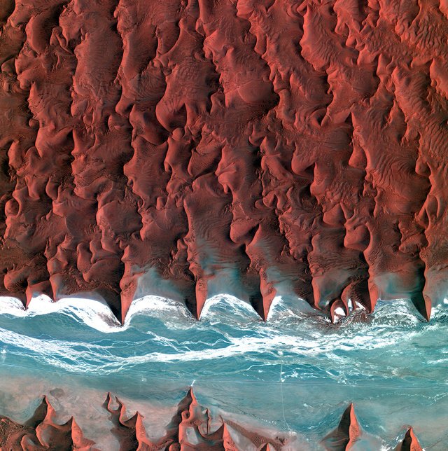
The ferocious teeth of the Earth dragon—the sand seas of the Namibia desert as captured by South Korea’s Kompsat-2 satellite. The complete photo at high definition and its descriptionfrom the European Space Agency
Stone Forest Kunming, the capital of Yunnan Province
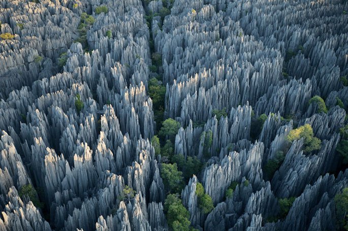
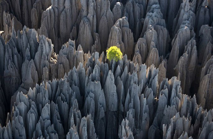
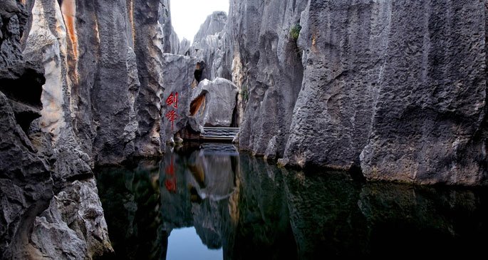 Kunming, the capital of Yunnan Province, enjoys great fame among tourists not only because the region features a consistently warm climate, but also thanks to its wonderful vistas and landscapes. Among the most dramatic of these attractions is the Stone Forest (Shilin), known since the Ming Dynasty (1368-1644 A.D.) as the ‘First Wonder of the World.’
Sailing Stones, Racetrack Playa, Death Valley, Calif.
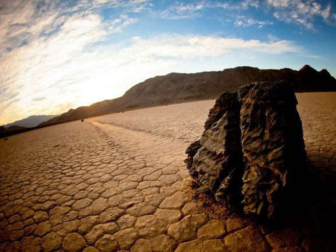
 There is something utterly magical about the sailing stones of the Racetrack Playa in Death Valley California. Scattered about the desert are large rocks with mysterious trails left behind them. The trails show that these rocks have rolled and zig-zagged across the ground, sometimes for as long as 860 feet. Yet no one has ever seen the stones actually move. The trails last for years before fading, so it is almost impossible to predict when the stones will move or how fast they move.
Door to Hell is an aptly named natural gas field in the Karakum Desert of Darweze,
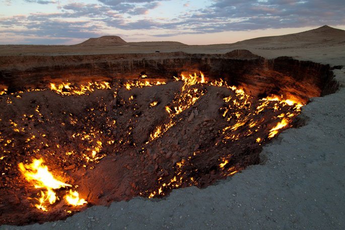
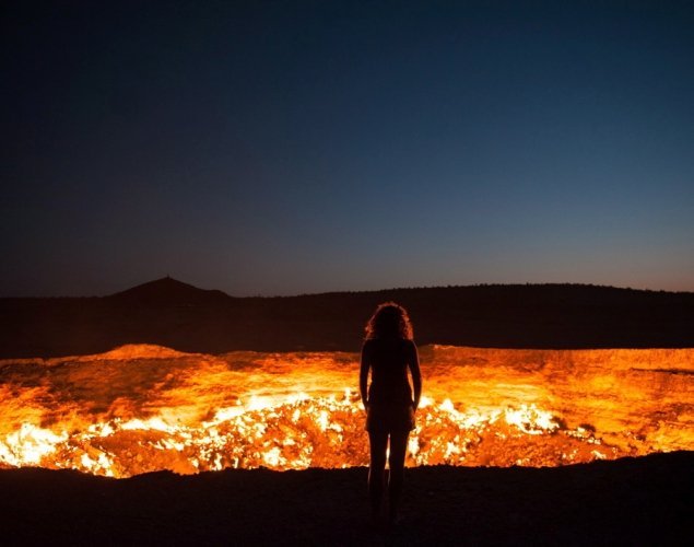 Turkmenistan that has been burning for over forty years. The flaming crater was originally a level surface identified by Soviet scientists in 1971 as an area rich in gas resources. Unfortunately, the ground collapsed under the weight and pressure of the drilling rigs set up at the site. Thus, environmentally hazardous methane gases were released from the massive depression, forcing scientists to take quick action and burn out the gases. What they didn’t expect was for the fire to last over four decades.
Considering the large size of the crater, containing the gaseous outbreak would be very expensive, which is why the scientists opted for an easier, more cost-effective, and what they presumed would be a quicker solution. The gas firing, a common practice for extreme circumstances like this 42-year-old incident, set the enormous basin ablaze and was expected to last only a few days. Instead, it continues to burn bright to this day. Now, it is a tourist hotspot (no pun intended), drawing visitors from all around the world to the inferno pit.


