


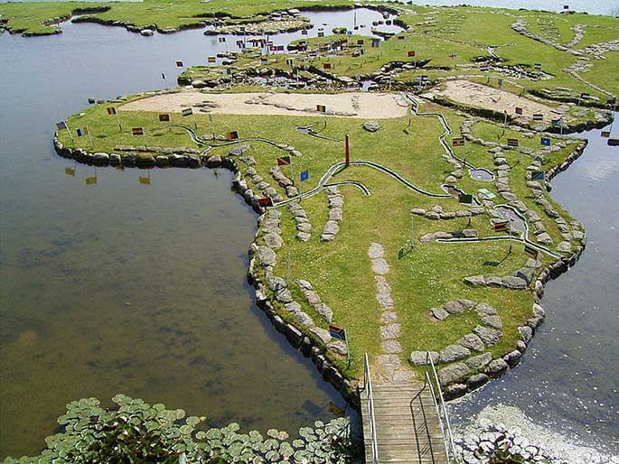
Mark this down as one of the stranger maps we’ve covered. Along the banks of Denmark’s Lake Klejtrup is a 4,000-square-meter map, built from stones, soil and grass. It’s creator Søren Poulsen spent the last 25 years of his life completing the walkable world.
Poulsen’s inspiration for the map came in 1943 while working on the drainage for meadows surrounding the lake. Finding a stone shaped like Jutland, he decided to complete his own map of the world using more materials from the nearby area. It was a project that would last from 1944 to 1969.
Søren Poulsen, the creator of “The World Map”, was born in Denmark in 1888. Having spent part of his life in America, he returned to the village where he was born by the lake in Klejtrup. In 1943, Søren Poulsen was working on the drainage of the surrounding meadows when he found a stone shaped like Jutland, inspiring him to create a small world of his own. The following year, with the help of primitive tools and a wheelbarrow, Poulsen started laying big stones on the ice on the lake, and slowly the World Map took shape.

Søren Poulsen continued building his map until his death in 1969. The final map measures 45 meters by 90 meters, and was built entirely to scale —one 111-kilometer degrees of latitude corresponds to 27 centimeters on the map. Today, the Verdenskortet ved Klejtrup Sø (Danish for “World Map at Lake Klejtrup”) is a popular attraction in the Viborg area.


The map as seen on Google Maps:


